Experience Mexico City's Public Transportation with Ease Using RedTransporteDFAPP!
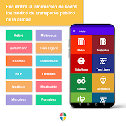
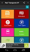
This app is your ultimate guide to navigating Mexico City's extensive public transport network. Covering over 1,000 stations across 32 routes, RedTransporteDFAPP helps you plan the best and most economical routes using Metro, Metrobus, Suburbano, Tren Ligero, and more.
Beyond route optimization (including cost, travel time, and transfers), the app offers a wealth of supplementary information: photos, videos, news, and articles – all accessible through an integrated Twitter reader. Plan your trip thoroughly before you even leave the house!
Key Features:
- Smart Route Planning: Find optimal routes considering cost and efficiency across various transport modes.
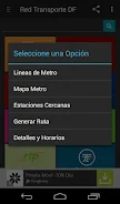
- Interactive Maps: Easily locate nearby stations and understand transfer points.
- Comprehensive Transport Coverage: Access information on Metro, Metrobus, Suburbano, Tren Ligero, and other options. Travel times and costs are calculated for you.
- Rich Media Content: Stay informed with pictures, videos, news, and articles.
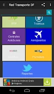
- GPS Integration: Locate specific transport options like Trolebuses and Pumabuses, and find nearby taxis.
- Offline Capabilities: Use offline maps and station views, and access pre-generated Google Maps routes.
In short, RedTransporteDFAPP is a must-have for anyone traveling in Mexico City. Its intuitive design and regular updates make navigating the city's public transport system a breeze. Download it today and enjoy seamless travel!


